Mijas Pueblo occupies an impressive location on one of the many hills of the Sierra de Mijas, standing amid a landscape of pine groves and offering stunning views of the Costa del Sol.
Its winding streets, charming nooks and crannies, flower-decked houses and tiny squares all contribute to Mijas' popularity with thousands of annual visitors.
The village is one of the most-visited destinations on the Costa del Sol. What is less well known is the surrounding countryside, the Sierra de Mijas: the Mijas mountains.
They are located in the inner part of the Cordillera Bética and divided into two sections: the Complejo alpujárride and the Complejo maláguide. A valuable mining area, the mountains are mostly comprised of marble and limestone.
The Sierra de Mijas offers the wealth of its flora, fauna, and landscapes, all within a short distance from the coast. It’s sharp geological characteristics, with peaks over 1000m, most facing different orientations, has produced some really varied microclimates.
The heavy, almost tropical-like vegetation on the northern valleys (particularly around Alhaurin de la Torre) contrast with the extremely dry and almost desert-like slopes just above Mijas. With such diversity, the hiking and mountain biking in this area is brilliant.
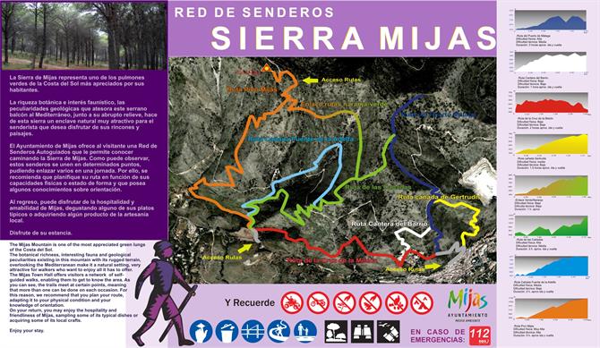
Most of the tracks are clearly labelled and easy to follow. The tourist office in Mijas provides maps of the area, with some set hikes marked on them.

A Hike up Pico de Mijas - La Bola
We are following the 'brown' route up the Sierra de Mijas’ highest point, the Pico de Mijas at 1,150 metres. This mountain is commonly known to locals as ‘La Bola,’ the ball, named after all the antennas on the top and in particular the ball-like meteorological station.
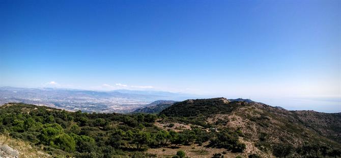
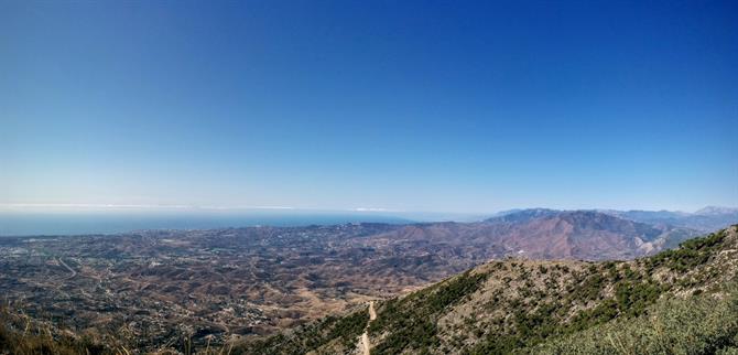
The views are spectacular and completely 360º. On a clear winter's day you get views across to North Africa, the whole of Malaga’s coastline, and looking northwards you have El Torcal and the mountains of Sierra de las Nieves. It's a truly breathtaking sight and well worth the effort in getting up there.
This particular hike starts in the centre of Mijas Pueblo and is classified as moderate to hard.
The best time of year for any hiking in Andalusia is from October to April. More so here, as there is no shade or water. The terrain is tough, with lots of rocks and sand and is slippery underfoot.
Bring water, sunscreen, a fully charged mobile phone, the track below and I’d recommend wearing long trousers. Just about every plant and bush out there is sharp and wants to hurt you.
The track below begins in the centre of the village. You can park in the large public car park that costs only 1€ for the whole day or you can drive further up the mountain and park near the forestry track that leads into the higher sections.


Details of the hike
Difficulty: Medium-hard
Route: Circular
Approximate time: 6 hours
Length: 14,5 kilometres
Minimum height: 405 metros
Maximum height: 1.150 metros
For some similar hikes in the area, see hiking up La Concha in Marbella and the hiking routes in El Torcal. For the more adventurous, you have the Axarquia's highest mountain - La Maroma and near Nerja, hiking up the majestic El Cielo mountain.
